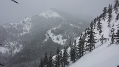
Lennox Mountain has been taunting me from afar since I first laid eyes on its rolling snowy slopes from somewhere within the Alpine Lakes Wilderness. I had hoped to continue on to Lennox after climbing Cleveland Mountain, and then from Canoe Peak but each time the summit seemed just out of reach. After conceding that this one would deserve the dedication of a full day, I began to look for the perfect snow conditions and weather forecast. With a Sunday that would live up to it's name and the lowest predicted avalanche danger in weeks I was confident that the third time would be the charm.
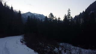
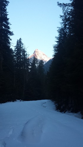
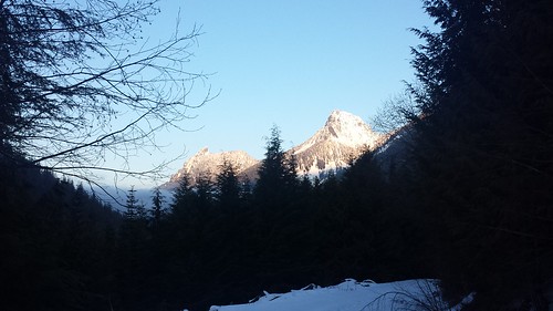
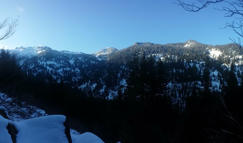
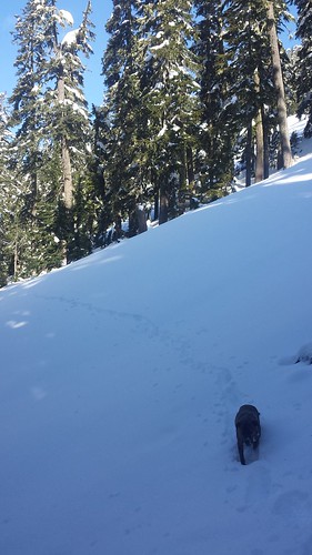
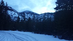
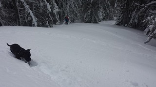
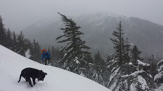
Lennox Mountain is ideally climbed (from the south, at least) with enough snow to ease travel through the thick brush which covers the forest floor for the first 1000' or so above the road. I was a bit surprised to find snow on road 5730 about 3 miles from the end. Some jeep ruts helped to get me and my crappy tires another half mile, and I was off with Maverick in tow by 6:30 am. The jeep tracks stopped just past Spur Road 113 where snowshoes instantly became necessary. McClain Peak and Mount Phelps lit up in alpenglow behind us, and what could only be Lennox Mountain briefly appeared ahead, though it looked oddly tame from this angle.
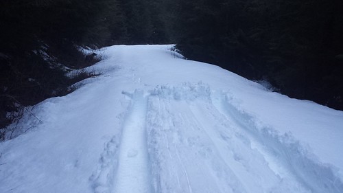
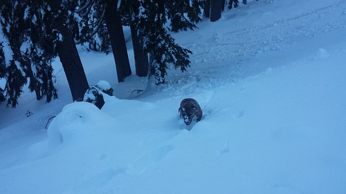
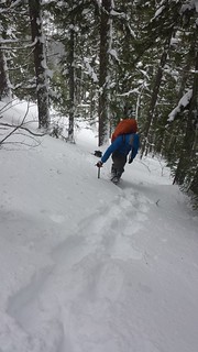
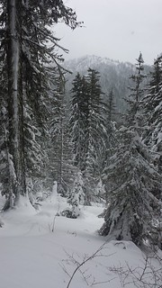
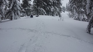
We left the road around 2600' in order to gain some elevation before crossing the next creek. While I thought at first we may have gone higher than required, we happened to cross just above the start of a deep, wide trench in the snow. I had hoped for a more consolidated snow pack but by 10 am the sun really began to bake the surface and each deep step brought with it a mound of slush caked onto my snowshoes. In a few steep sections I was forced to make painfully mellow switchbacks so that Maverick could get somewhere with his efforts.
This was my and Colin's first outing with the Mountaineers. When we saw a new summit listed as the destination for a conditioner we jumped at the opportunity to avoid a weekend trip to Mount Si. With no recent beta I set my expectations low as our convoy climbed as close to the trailhead as the snow would allow. We made it to about 3600' and after a quick weigh in we were breaking trail under rolling snow clouds. The overcast layer slowly rose through the day and provided several sun breaks, as well as a few brief flurries.
Bearhead and Pitcher Mountains each came into view during the roadwalk. We reached the trailhead in just over an hour. Twin Lake was hardly noticeable under snow when we cruised past it. Beyond the lake snowshoeing was a pain on the steep traverse and the trail became faint. Beyond that the slopes grew steeper as we climbed higher, some of us even debated switching to crampons. Around 5500' we reached a clearing with a nice little bench just in time for a short break. Beyond Cayada Mountain Tolmie, Howard and Florence were capped in snow.
We initially planned to snowshoe up the Alpine Lookout near Lake Wenatchee, but after checking the cameras at Stevens Pass we chose to find something to do along Snoqualmie Pass instead. I can usually count on some sunshine Easton area when precipitation is scattered throughout the Cascades. This time we were merely taunted by the sun which remained hidden behind a high overcast layer despite making dozens of appearances. Several feet of fresh snow meant we were working for every single step. Thanks to heavy snowmobile traffic we were able to boot the first 3/4 mile, but the next stretch was the slowest I have ever moved over flat ground. This was the first time I have utilized the 6" extensions for my snowshoes, which seemed to make little difference. We finally reached the trailhead after an hour and a half, where we took the first break to refuel by the dam on Silver Creek.
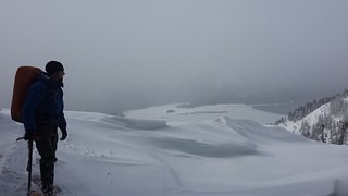
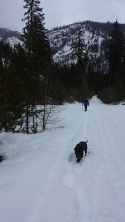
Once we began to truly ascend it became clear that we had already found our max speed. Each step up was rewarded by half a step back down as our snowshoes sunk deep into the powder. We were able to follow the trail for the most part until about 200' below the first junction on the west end of Easton Ridge. We reached the signed junction nearly 5 hours after leaving the truck. It was becoming clear that we wouldn't be reaching our destination by our predetermined turn-around point. We took a break and decided to continue on our planned route up the Domerie Divide Trail and hopefully reach Para Point before retreating.
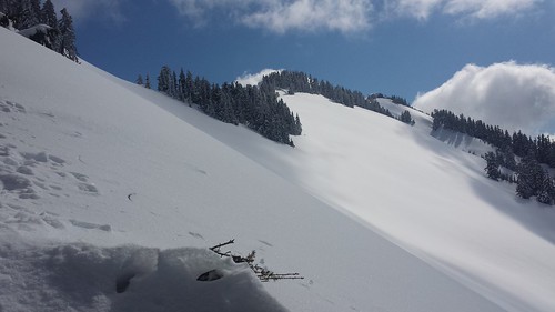
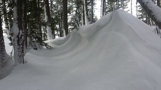
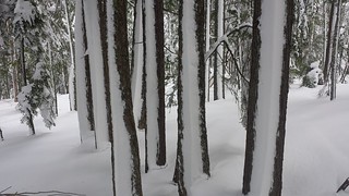
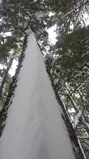
We stayed close to the edge of the trees, being careful to avoid the exposed cliffs to the west. Throughout the day we heard at least 5 separate short whoosh and booms which we assumed to be small avalanches in the Silver Creek Valley. Dozens of small cornices littered the mostly flat, wind swept forest. Most of the larger tree trunks were plastered with triangular prisms of snow on the windward side. A group of four appeared below us around 3400'. They thanked us for breaking trail and we let them pass while we sat down on a mellow sloped ledge to take a break.
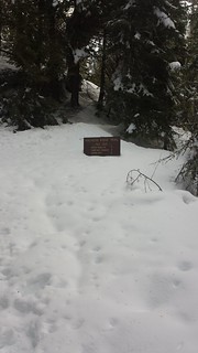
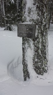
Easton Ridge was barely visible through the falling snow, which was building in size and momentum by the minute. The descent was quick and pleasant. We were surprised to find that some of the barely hour-old tracks had been completely covered by fresh wind-blown powder. I noticed a small memorial to Richard Woodworth on a tree west of the Easton Ridge/Domerie Divide junction.
Mount Townsend in the Olympics seemed like a relatively safe option given the considerable avalanche danger forecast. I wasn't too hopeful about reaching the trailhead by car so i planned to use nearby Green Mountain as a backup in case the snow stopped me more than 4 miles away. I played it safe and pulled out at a break in the ruts about 7 miles out when about 6 inches covered the road. It snowed lightly most of the day besides a few short sun breaks.
We followed Road 2812 for a few miles before heading up an unmarked road at the base of a short ridge that branched off of the north to south ridge that makes up Green Mountain. In less than a mile I reached the roads end and began the bushwhacking. After struggling with thick snow-covered brush for about 20 minutes only to gain about 50', I turned back and began to think more about tomorrow's summit with Colin. On the return I found a fresh set of ski tracks joined by a dog, and passed the pair as they were loading up to leave. A long drive for such a short snowshoe, but better than sitting home or getting rained on elsewhere!
The last few weekends have been filled with plans which kept me away from the mountains, but I did get a bit of adventure with my nephews yesterday. As a dual birthday present I brought them to Stone Gardens in Bellevue for some indoor climbing. Each time I visit a climbing gym I can't help but think of how much fun it would have been as a kid with never-ending energy. I'm still missing the mountains, but a chance to re-live childhood vicariously will subside my cravings until next week.
I was looking to bring a friend on a shorter summit trip that would allow us to be in Seattle by noon. This short hike is surprisingly popular among NW Hikers likely due to the high visual payoff and low physical cost. As a bonus I would get a look at the new section of the Pratt River Trail, which we left almost as quickly as we met it. On our way through North Bend the fresh snowline on Mount Si was crisp and clear.
We followed a faint bootpath along the top of the ridge which became more clear as we climbed. About halfway up we were treated to stunning view of Mount Garfield mostly covered in snow. Near the top Mount Bessemer and part of Preacher Mountain appeared.