Where I've Been


View Jeb's Journeys in a larger map

Saturday, October 17, 2015

Another week in The Enchantments
Day 4: The Big Traverse


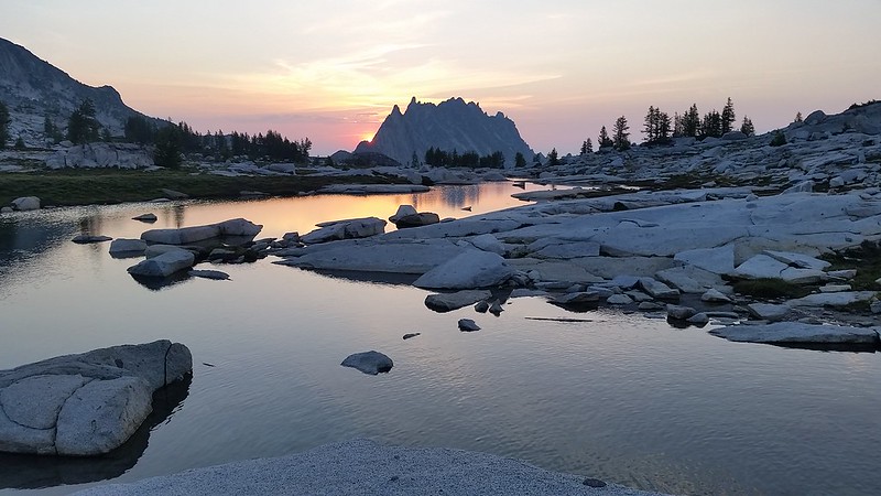
The lofty, yet realistic goal for the day would be to reach the summit of Argonaut Peak and bivy somewhere below. The pipe dream was to maybe have enough time and energy to continue on to Sherpa. There is very little beta on the Stuart Range traverse available on the internets, but I had pieced together a few helpful tidbits.

I had initially planned for an alpine start, but after discussing a potential timeline we settled on leaving camp at 5. We ascended Dragontail Plateau from south of the ridgeline, crossing only about 200 feet of snow at the saddle. From the west rim of the plateau we located Colchuck Pass and a few potential lines on the east face of Dragontail's SW ridge. We knew that Pandora's Box would be melted out, and my experience with Colin the year before had us highly motivated to avoid it.

The four of us had been to Dragontail so we bypassed the summit, keeping our eyes on the prize. We boulder-hopped down the valley and chose a ledge just south of the pass. Around 200 feet from the top we reached a low 5th class face with a 3 foot wide chimney to the right. We hauled our bags up behind us and found an easy scramble on the other side. A group of three approached Pandora's Box from Colchuck Peak as we started down into the valley. They quickly decided to abandon Dragontail and returned down the Colchuck Glacier.

We filled up on water where the creek passed under a giant boulder. This is where Argonaut came into clear view and the north face seemed to look like a simple scramble. After getting around a 200'+ clean looking vertical to overhung rib I could see that the ramp we had spotted would go. Colin was pretty sure that we would need to lose at least 800' on the other side to reach the south col, and the northern saddle above was so close we couldn't resist having a look. We had, after all, brought rope and a few pieces of pro.

At the saddle we found a great campsite with views of Argonaut's north face as well as Sherpa and Stuart. The ridge up to the north face look surprisingly mellow despite a steep drop off to the north, but some of the route was obscured so I dropped my pack and headed up the ridge for a closer look. The ridge ended in a butter smooth slab above a narrow col. A small ledge below brought me into the col and seemed to continue to a larger system of grassy ramps. If we could get across the col, the remainder of the climb would be simple. Unfortunately it was filled with several feet of 50+ degree hard snow, and about 10 feet wide where we would need to cross it.

I returned with the bad news and we left our killer campsite behind. We happened across another amazing bivy site with plenty of flat sand to accomodate the four of us and even a grassy pillow for a few. We ascended the ledge and found a few options before us. A few hundred feet above and to climbers left was passable terrain and maybe a route to the summit, but Colin was sure that we would need to lose several hundred more feet to avoid getting cliffed out above. Around 500 feet below, we began traversing and Nick decided his blisters would not allow him to continue.

Rob and Nick returned to camp and Colin and I continued on. Thanks to the GPS we could tell that we were on route in the South Col, but Colin was having a hard time recognizing the terrain, which had been buried in 20+ feet of snow when he was there last. We noted a few potentials return routes that may save us some elevation on the way down. We ascended clean white ledges with a few sketchy moves here and there, and soon enough we were just below the summit looking up at the rap station. We climbed up a very fun chimney choked with chock stones and then inched around an exposed ledge before the final scramble to the top.

It felt great to finally reach the summit, after starting our journey nearly a year ago. We looked down at the ridgetop camp, and half-considered exploring a route down to avoid the extra elevation loss the way we had come. After a short discussion we agreed that we would be better off exploring the higher traverse that we had considered on the south side. We managed to find workable route which saved about 400 feet, but we did opt to rappel down one 40' pitch of low 5th class rock along the way. Colin radioed ahead and as we rolled back into our bivy site just before sunset we were greeted with fresh hot water for dinner.
20150710_052643

Friday, October 16, 2015

The Teardrop Chronicles Part 4: New Orleans to Florida

Day 9

 Leaving New Orleans was bitter sweet, as a city with so much culture could never be properly experienced in just a few days. The short drive through southern Mississippi and Alabama was interesting, to say the least. The moment we crossed the border from Louisiana we really began to miss the perfect road surface and seemingly endless speed limits of Texas.

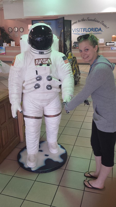
 I was able to convince Steffy to take a detour with me to visit Lakewood Park, where we climbed to the highest point in the state of Florida, 345 feet above sea level. Fun fact: Florida's highest point is lower than the lowest point of 16 other states. The rest stops in Florida, complete with staffed visitors centers, jets and astronauts came the closest to messing with Texas. We set up camp at the resort and before we could finish dinner we were greeted with the first of many Florida downpours.

Day 10

Our first stop was Disney's Animal Kingdom, This had been Steffy's dream from childhood, and unfortunately it did disappoint. The zoo portion was cool for a zoo, but the entire experience was underwhelming. Nearly all of the animatronics  were from the original park opening in 1998, and had clearly not been updated or likely even maintained since. I will say that we did enjoy about a half hour watching monkeys tease one another and swing around their enclosure.

Intent on salvaging the day, we hurried over to The Magic Kingdom. Steffy got her disney-star wars fix and I had satisfied my adrenaline craving just in time for another heavy Florida rain. We hid inside for a few hours at the World of Tomorrow, which reminded me of the Seattle Space Center.
Before we made it back to camp the rain had returned, and continued for nearly the rest of our 6 day stay.

Day 11-14

The rest of our stay at Disney was a blur. We had a blast at Epcot and Disney's Hollywood Studios, but there was so much constant rain coming down in sheets that we spent most of our time running from cover to cover. We had prepared for rain, but our elaborate tarp system required constant management due to the sheer volume. At this point I was very thankful that Steffy had convinced me to install the A/C unit. The lowest nighttime temperature we had was 86 degrees, and humidity was through the roof.

Our schedule allowed for two rest days amidst our Disney adventure, and we had also hoped to spend a day visiting the Coral Castle. The weather , however, was not cooperating so after 5 days of rain and an increasingly dismal forecast we bailed 2 days early. We both eagerly fled Florida, excited for anything else. Good Riddance!


20140927_092409

Friday, October 2, 2015

Mount Thomson West Ridge 9-27-2015


Mount Thomson via West Ridge


Colin and I have both wanted to climb Mount Thomson since before we met and we've been discussing it regularly for over 2 years now, so of course we were both stoked when the weekend we tentatively put aside arrived, promising clear skies on summit day.

A leisurely start on Saturday morning got us to camp before 2 o'clock. Bumblebee Pass seemed much larger and more daunting when I first visited 3 years ago. Huckleberry Peak was picturesque as we descended into the basin, surrounded by low clouds. We set camp near a small pond on a grassy knoll high in the basin and waited for the weather around Mount Thomson to clear. 

When the clouds remained for several hours we started up towards the West Ridge Notch to find the start of the climb. An obvious belay station sat about 100 feet below what could only be the "bushy tree" at the top of the first pitch. After scrambling SW to a tiny peak we were lucky to get a 5-minute clearing - and even a bit of sunshine to light up the route - before the whiteout returned. Satisfied with the beta, we carefully returned to camp over some extremely loose talus.

As we lounged in the tent watching weather move through the basin a deep, distant rumble slowly built to a scream and I instantly realized what we were hearing. I have read several accounts of fighter jets flying low through the Alpine Lakes and I've always hoped for a chance to witness this unnatural phenomenon. Despite the clouds that were still surrounding us in all directions, we instinctively jumped out of the tent, looking down the basin toward the only small clearing. As if on cue, the jet burst forth from the white, banking as it tore through the saddle behind Huckleberry Mountain and returned into the clouds. After a brief fit of childish excitement I was reminded of the mixed feelings I hold regarding these incredible machines.

When I awoke around 2 a.m. our tent was glowing with moonlight. I emerged under the stars, immediately disappointed to find a small cloud hovering around Mount Thomson. My brain immediately drew parallels to our recent bail on Mount Stuarts West Ridge but the sky was otherwise clear so I returned to bed, optimistic that the forecast would prove to be accurate.

Sure enough, when our alarm sounded we found nothing but crisp, clear air between us and our target. It was so much colder than expected, that we wore our puffys up to the notch. Colin lead the first pitch, and as I started after him the ice cold rock made me wonder if we had started too early. The sun had just crested over The Four Brothers, but our position on the West Ridge guaranteed us several more hours in the shade. I was beyond stoked upon reaching the large slabs below the false summit, finally removing my puffy to soak up some sunshine. 

Besides the cold start, the climbing was excellent. There were plenty of options for placing pro along the route, except for a 20' stretch just below the false summit (Pitch #4). If we were to do this one again, a second 1" and 0.75" cam would be helpful. When we reached the summit it was clear that we had not, in fact, started too early. It had taken us nearly 6 hours to climb 5 pitches, which was not surprising considering our general lack of experience trad climbing.

Views from the summit were fantastic. Many years of anticipation made this a particularly significant accomplishment for both of us. We toasted with various summit treats while counting dozens of surrounding peaks from which we've gazed upon Mount Thomson with yearning desire. Most notable were the peaks surrounding and beyond Gem Lake, where Colin and I took our first, and arguably most successful peakbagging trip together. It was a bit of a struggle to open the pvc summit register. We found a few familiar names as well as an entry from a threesome from the day before, who we must have just missed on their way out.

The decent was fairly simple, although we made the common mistake of taking the wrong gully, requiring 
a short rap and a bit of mildly sketchy downclimbing to get us back on course. A series of well-worn bootpaths brought us to the east notch, where we took a short break in the sun, watching shadows stretch across the basin toward us. We packed up quickly hoping to catch some more sunlight on the trail out, as well as some of the views we missed out on during the approach. On the hike out we passed about a dozen folks on the PCT, a few of who mentioned they were headed for Canada. So jealous...

13 miles 
4800' gain
4 hours to camp
7 hours to summit
5 hours summit to trailhead