Where I've Been


View Jeb's Journeys in a larger map
Showing posts with label Snowshoe. Show all posts

Monday, March 23, 2015

Glacier Peak in 48 hours: Type two fun, defined 3-7-2015


2015-3-7 Glacier Peak


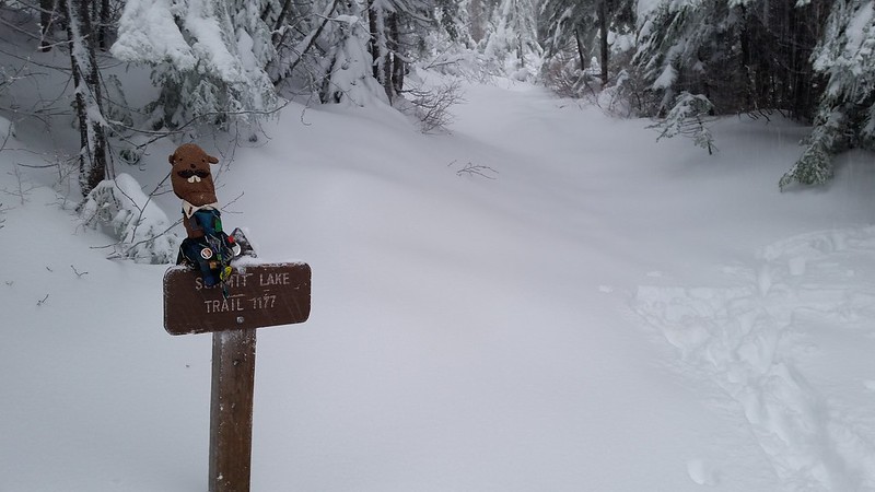
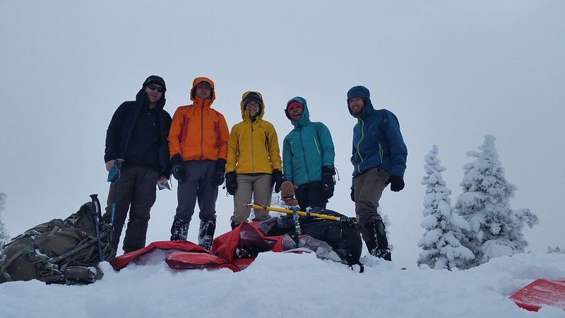
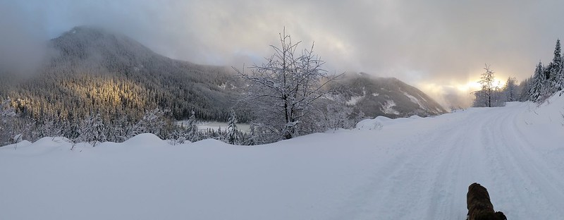
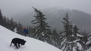
Tahoma was the first epic plan for the weekend, but the road to Sunrise is still gated at Crystal and I've got my heart set on the Emmons.  Colin assured me that 3 full days for Glacier Peak is overkill, so we recruited Camille and hit the North Fork Sauk River Trail just after 7 on Friday night. We were aware that there is no camping allowed on the ridge at White Pass,  but unaware of 2 campgrounds in the basin to west. We set up camp at the Mackinaw Shelter at 10 and planned for a 3 am wake-up call.

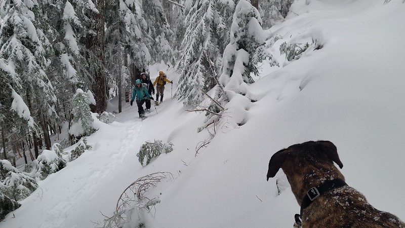
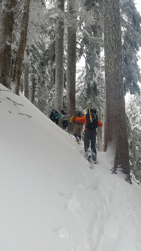
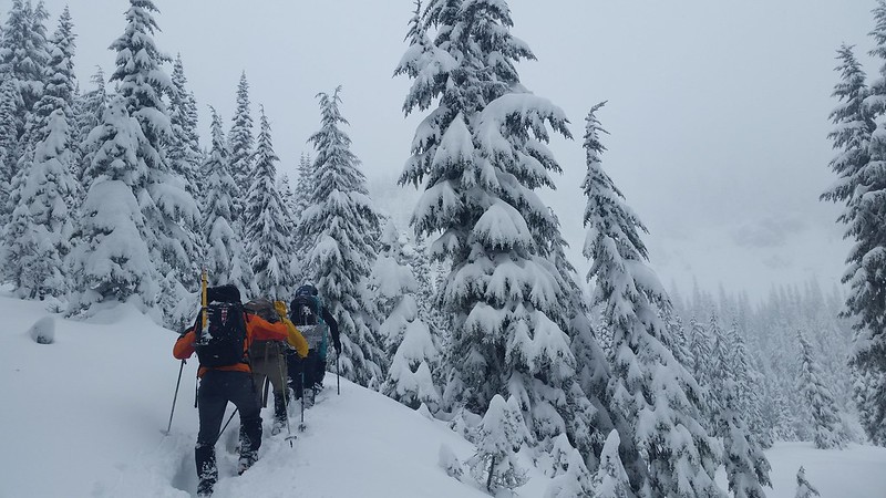
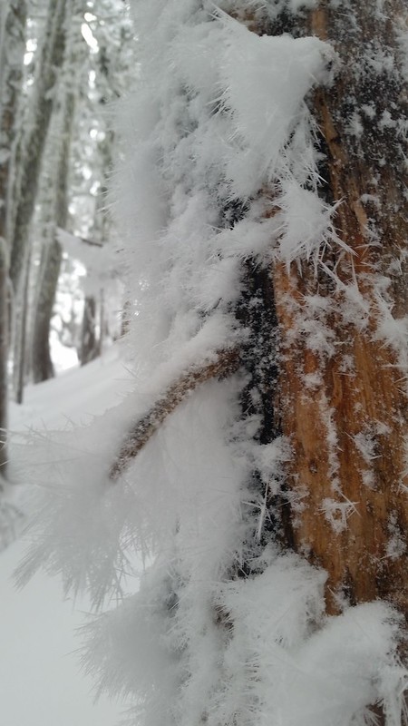
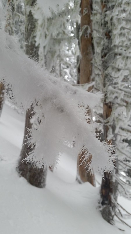
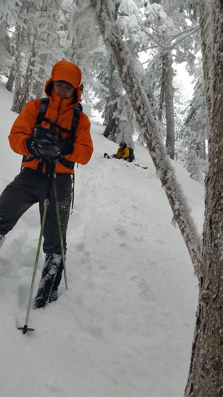
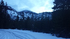
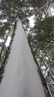
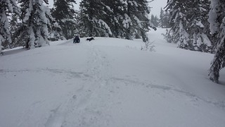
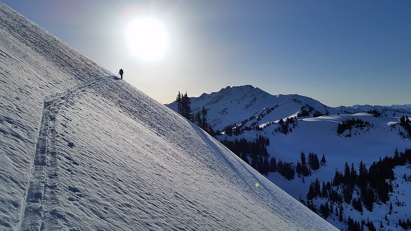
After a slow breakfast we started up the 28 switchbacks to the PCT. Snow appeared around 5000' and covered the long traverse to White Pass. We put on crampons for the last mile or so, following some ski tracks above steep slopes. We stopped at a few spots of melted out trail to watch the rising sunlight on Sloan Peak and the Monte Cristo Group behind us. The skiers whose tracks we followed were camped at the pass. We exchanged pleasantries while taking a break before continuing on. We quickly agreed to change into snowshoes after a few some post-holing.

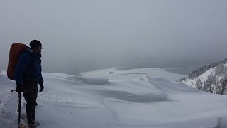
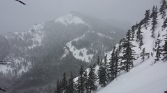
When we reached the saddle two peaks west of Point 6770 our distant target finally appeared across the White Chuck Glacier.  Crampons went back on for the traversing descent down the shady side of the ridge. They were again traded for snowshoes as soon as we hit the sun baked glacier. It was getting late in the day, and I was intent on making up for lost time on the way to High Camp but snow conditions were just not cooperating.

 When we reached High Camp we melted snow and reassessed. Camille decided that she would wait behind so we planned to return by 5, giving us 4 hours for the round trip. This would turn out to be a hopelessly optimistic plan. The Cool Glacier looked smooth as butter, and Colin was confident we could avoid the few crevasses he saw last summer so we left or rope and harnesses. We plonked our snowshoes into the edge of the Cool as the sun left it and hauled ass across to the next saddle, pausing once to watch rock peel away from the east face of Disappointment Peak.

On the north side of the glacier we met 2 skiers on their way down. It was nearly 5 o'clock, our planned return time to Camille at High Camp. We were moving far too slow,  but i could not resist the summit fever. One look into Colin's eyes and I knew that no discussion was necessary, and we continued on. The next 1000 feet came and went at a painfully slow pace. Colin was lagging behind but I kept moving as the sun began to set behind Mount Pilchuck. I ascended the final stretch between rime-covered rock and stepped onto the summit in time to catch the last few minutes of sunlight.

Colin joined me and we wasted no time before starting the descent. It was 6:15. We were a little worried about Camille, and regretting or decision to continue on. A single headlamp could be seen on the White Chuck, so we flew back down to High Camp as quickly as ore legs would carry us. We were both getting low on water and wanted to catch Camille in case she took the stove with her. Regardless of our choice to continue past our agreed return time, it would have been wise to further discuss contingencies before splitting up our group. Colin was hopeful that Camille would still be waiting for us, but when an hour after sunset we were still below the short elevation gain back to High Camp I knew that was a long shot. I couldn't blame her if she had to get moving to stay warm, or worse that she assumed something had gone wrong. I started to feel terrible for putting our friend in such a position.

We were elated to find the stove waiting for us, although it was now clear that we would be chasing Camille back to camp. After quickly depleting or fuel we quickly repacked and headed back as moonlight descended upon the White Chuck Glacier. This was the beginning my separation with Colin.  I would stop each time his light was lost behind me, but by the time he reached me my toes began to freeze, and I was growing more concerned that Camille might decide to continue past camp in search for help.

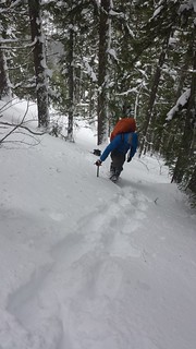
We post-holed most of the way across the White Chuck, too stubborn to switch to snowshoes yet again. This was a poor decision as the rapidly cooling surface grew less consistent, breaking randomly under every third or fourth step. The final ascent and return to White Pass was grueling. When I noticed it was 1 am, I waited for Colin to catch up one final time. I  expressed my concern that at the rate we were going, we wouldn't reach camp until nearly 3 o'clock. Colin was moving as fast as he could safely and we agreed to split up so that I could reach Camille asap.

When I returned to camp I was relieved to find Camille fast asleep. My attention to immediately turned to hot food but the filter was with Colin and I was not excited at the prospect of boiling water from the creek, so I drank my last sip of water and crawled into my bag to await his return. I awoke with my headlamp still on as Colin joined us in the tent and we both passed out, no longer concerned with dinner.

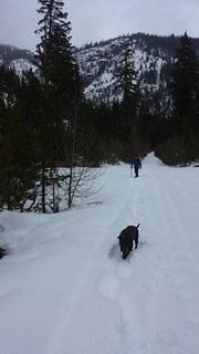
 When I woke up naturally at 7 Colin asked me what the hell I was thinking and Camille opened her eyes long enough to smile at the realization that we were back safe. They both promptly went back to sleep until I roused them at 2 p.m. to suggest we break camp and get back to Granite Falls while Playa Bonitas was still open. On our way out the trail seemed to have grown since we last traveled it less than 48 hours prior. Like I said - "Type 2 fun, defined.

Tuesday, December 30, 2014

Bearhead Mountain: The return of aDam 2014-12-28


aDam is back! He joined me and a few friends on a trip up Bearhead Mountain last weekend. Snow levels were similar to my first attempt on this peak, but this time it was a few feet of fresh powder all the way to the top rather than the springtime snow we experienced in March. Nellie's car stopped around 3500' on the road just after light rain turned to snow. Colin dropped me off with Maverick and some gear near the trailhead and ferried the rest of the group back in his jeep.
I started slowly up the trail to stay warm, sinking at least 6 inches with each step. Everyone else caught up below Twin Lake and we took turns breaking trail for the mile-long traverse. Much of the bear grass and branches were covered in newly-formed hoar frost. As we reached the SE ridge, the slope mellowed and the trail disappeared into smooth powder.

20141228_085235 20141228_094623
20141228_105831 20141228_113320
20141228_105324 20141228_112851

The snowfall stopped around halfway up the ridge, and we got a few brief glimpses of blue sky. Breaking trail uphill became more challenging with every step. The final 400 feet took us an hour to climb. We experienced some "whoomping" and found a few fractures in the snowpack, and had a quick safety meeting to insure that everyone felt comfortable continuing. We plotted a route through the trees, keeping a safe distance from the steeper slopes to the east.

20141228_114911 20141228_121150

There was very little wind at the top, but it was still pretty cold. Maverick was not happy to be stopped, so we built him a dog cave out of emergency blankets. We ate lunch on the summit, looking down at the spot where Colin and I turned back with our Mountaineers group in March.

20141228_122339 20141228_133042
20141228_134436 20141228_134604
20141228_135404

I cannot describe how great it felt to fly down at high speed after such a brutally slow ascent. We cut most of our switchbacks, alternating between plunge-stepping and a standing glissade back to the traverse. Colin and I reached the trailhead quite a bit before the rest of the group so I continued on with Maverick towards Nellie's car, accompanied by the sound of gunshots and occasional sunshine.

20141228_142451 20141228_142525 20141228_142609
20141228_143120 20141228_151209
20141228_153820 20141228_155122
20141228_155303

9 miles round trip 1800' gain

Friday, December 5, 2014

2014-11-30 Bean Peak, plus Marys and Judis


Colin and I decided to take advantage of the decent weather forecast for Thanksgiving weekend. After some debate we settled on Bean Creek Basin near the Teanaway, and a few peaks surrounding it. Frigid temps were expected everywhere so we left the dog behind this time. We had a few slowdowns getting over the pass and up the snow-covered North Fork Teanaway Road, finally arriving at the trailhead at 10 am on Saturday. We found a good campsite near the top of the basin and crashed early with plans for an alpine start the next day.

20141129_101629 20141129_120827 20141129_143035

We woke at 2 am and quickly chose to forego the early start and went back to our cozy sleeping bags until about 6 o'clock. I was glad for the later start when my toes began to freeze as the alpenglow enveloped Judis Peak above us. There was quite a bit of exposed rock at the top of the ridge, so Colin traded his ancient snowshoes for crampons. Low clouds hung around 4000 feet over the I-90 valley but we had a clear view from Mount Adams to the Stuart Range. At Judis Peak we chose to drop down into Fourth Creek Basin towards Devils Head, which would make for an easier approach to Bean Peak.

20141130_073053
20141130_083310
20141130_083345 20141130_085704 20141130_092613

We passed some fresh coyote tracks just below Volcanic Neck where we stopped for lunch. The scramble around the west side of The Neck looked a bit sketchy with current snow cover, and the trail on the east side crossed some steep slopes with less than ideal runout. We chose to leave the rest for another day and made our way to Bean Peak.

20141130_112930 20141130_112936 20141130_114421

The summit was pretty windy, but it was nice to get back into the sun, which was finally providing noticeable warmth. I removed snowshoes for the descent , which was mostly melted out rock. We returned to camp and packed up quickly as a wall of shadow stretched across the basin toward us. Most of the small creeks we crossed on our way out were frozen over. We made it back to the truck well before sunset and slowly weaved our way home through holiday traffic.

20141130_124329
20141130_134034
20141130_151905

11 miles ~4200 feet gain

Thursday, February 27, 2014

Thomas Mountain (Attempt) 2-22-2014

We initially planned to snowshoe up the Alpine Lookout near Lake Wenatchee, but after checking the cameras at Stevens Pass we chose to find something to do along Snoqualmie Pass instead. I can usually count on some sunshine Easton area when precipitation is scattered throughout the Cascades. This time we were merely taunted by the sun which remained hidden behind a high overcast layer despite making dozens of appearances. Several feet of fresh snow meant we were working for every single step. Thanks to heavy snowmobile traffic we were able to boot the first 3/4 mile, but the next stretch was the slowest I have ever moved over flat ground. This was the first time I have utilized the 6" extensions for my snowshoes, which seemed to make little difference. We finally reached the trailhead after an hour and a half, where we took the first break to refuel by the dam on Silver Creek.

20140222_065338 20140222_075036 20140222_084609

Once we began to truly ascend it became clear that we had already found our max speed. Each step up was rewarded by half a step back down as our snowshoes sunk deep into the powder. We were able to follow the trail for the most part until about 200' below the first junction on the west end of Easton Ridge. We reached the signed junction nearly 5 hours after leaving the truck. It was becoming clear that we wouldn't be reaching our destination by our predetermined turn-around point. We took a break and decided to continue on our planned route up the Domerie Divide Trail and hopefully reach Para Point before retreating.

20140222_102940 20140222_110839 20140222_112058
20140222_113008(0) 20140222_113117 20140222_113150

We stayed close to the edge of the trees, being careful to avoid the exposed cliffs to the west. Throughout the day we heard at least 5 separate short whoosh and booms which we assumed to be small avalanches in the Silver Creek Valley. Dozens of small cornices littered the mostly flat, wind swept forest. Most of the larger tree trunks were plastered with triangular prisms of snow on the windward side. A group of four appeared below us around 3400'. They thanked us for breaking trail and we let them pass while we sat down on a mellow sloped ledge to take a break.

20140222_122805 20140222_123310 20140222_124040
20140222_125802 20140222_142641
20140222_144448 20140222_154851 20140222_155731

Easton Ridge was barely visible through the falling snow, which was building in size and momentum by the minute. The descent was quick and pleasant. We were surprised to find that some of the barely hour-old tracks had been completely covered by fresh wind-blown powder. I noticed a small memorial to Richard Woodworth on a tree west of the Easton Ridge/Domerie Divide junction.