Where I've Been


View Jeb's Journeys in a larger map

Saturday, December 22, 2012

Lowland Peak Bagging in Enumclaw 12-22-2012

Since this trip, I have been informed by several individuals that the summit of Baldy Peak is on private property. I have not been able to confirm this, so I suggest that anyone interested in visiting the top first take the time to find out for themselves.

With fresh powder dropping everywhere of interest in the cascades, and still no snowshoes, my eyes turned to a few small knobs near Enumclaw. I started the day with St Paddy's Peak just South of Kanaskat-Palmer State Park. From 343rd Ave SE I took the second left and parked at the gate. It drizzled as the Automan and I ascended the grassy logging road the 1.3 miles to the summit. We were greeted with better views than expected from such a low peak.
Next stop was nearby Baldy Hill, where I met up with 2 friends with a schedule for the day. It should be noted that the Hancock Timber Co. purchased this land from Weyerhauser and now charges for motorized and non-motorized access. After turning South up a well-beaten path just past the power lines, the hike turned into a serious bushwhack.
This summit provides substantial views to the Southwest and Southeast, including Pinnacle Peak, Mud Mountain and The Three Sisters. While researching the hike I came across records of late 19th century newspaper articles which reported explosions and smoke from Baldy Hill, and speculated that it erupted. Three things are certain: 1. It has been confirmed that the peak was once volcanically active, 2. The City of Enumclaw says the name means "thundering noise" 3. There are rock formations on the summit that look suspiciously similar to cooled molten rock. We managed to stay on a few of several named horse trails on the return and avoided any further bushwhacking. I've included only the gpx track from the decent for clarity. My friends did not have time to join me on an attempt on Radio Peak so decided instead to head to Pinnacle Peak, which they had both climbed before. The well-groomed Cal Magnuson Trail was a pleasant change from all the road walking. The Columnar Basalt along the trail below and north of the summit is beautiful. I was surprised to find foundation blocks from a fire lookout tower that once stood at the top.
Not quite satisfied and with a still-energetic pup, I returned to the north and engaged in some more road hiking on the way up another small peak west of St Paddy's. I have only seen this peak strangely named "Bayne Existence" in a few searched on the web. From Cumberland-Kanaskat Rd to the East, several semi-smooth looking rock faces are visible near the top. I found the summit itself to be hardly worth the trip through thick sticker bushes and devil's clubs surrounding it, but being so close, I suffered through and brought my poor dog with :p

Sunday, December 16, 2012

Low Mountain in a Blizzard 12-15-2012


Low Mountain has been on my radar for some time now, having failed two summit bids due to soft snow and lack of proper gear. So needles to say, I was stoked to see a recent trip report by a few NWHikers with snowshoes. Thanks to Gimpilator, EastKing, and Jacob Smith for packing down a nice trench for me!


The road is covered in snow from the junction at Asahel Curtis, and I was lucky to make it within a 1/4 mile of the trail head (which was covered in 1-2' of powder)  with balding passenger tires.


Leaving the car just before 8 o'clock, I made good time up to the first crossing of Denny Creek which had just enough solid snow to make a safe crossing. The first talus field caused me a few post-holes but by the second open section the trench began to fill in with powder, providing a little more staying power.


As forecast, snow began to fall around 9:30 and the wind began to pick up as I approached the pass. Beyond Hemlock Pass the trench was only sporadically visible under several inches of new snowfall and drift. There were a few short sections where the ridge became very narrow with significant exposure on either side providing some route-finding challenges between trees and away from corniced edges.


Before I had descended half of the North ridge, my own trench was almost indistinguishable under heavy snowfall and wind drift. As is my usual luck, the fog began to lift and the snowfall slowed within 20 minutes of leaving the summit. Between the pass and the falls I encountered a pair of skiers skinning their way up and a group of over a dozen snowshoers on their way to Melakwa Lake.

Friday, December 14, 2012

Thompson Point and the Cabin of Mystery 12-13-2012


Reaching summits in the Washington Cascades this time of year can be difficult without snowshoes, and since I still don't have a pair I have been taking advantage of NWhikers as well as the WTA site in order to plan my ascents in the tracks of recent snowshoe trips, with varying success. Yesterday I managed to bag Thompson Point thanks to trail-breaking by a few NWhikers on Sunday. Thanks puzzlr, Mugs, and RichP!!! I may not have made it without your help.


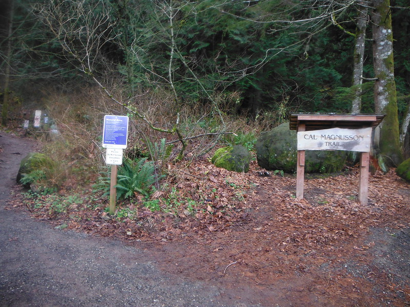
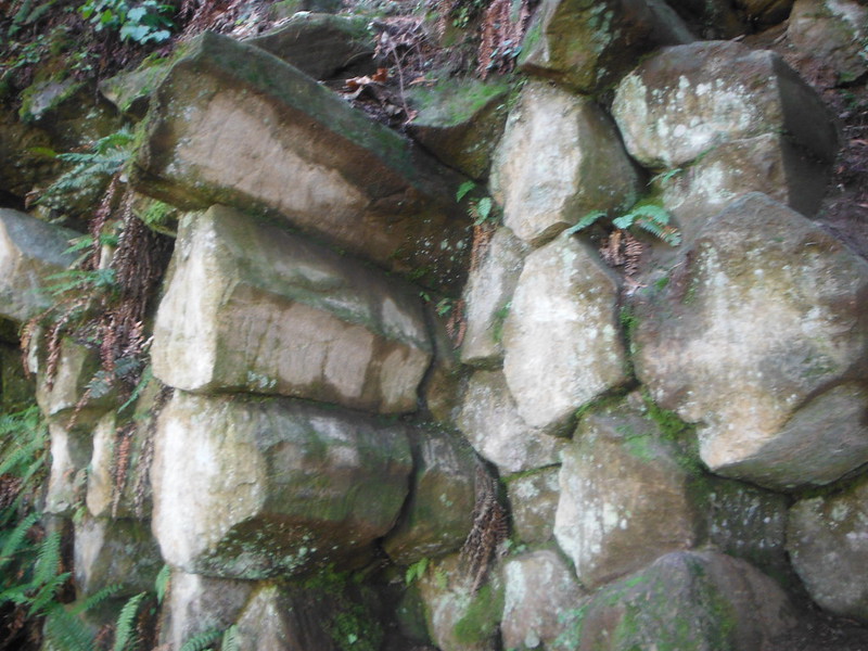
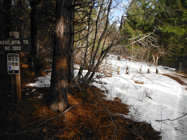
I have to second puzzlr's praise for the beautiful trail work by Charles Murray  that transformed this dreary old logging road, it was a pleasure to hike! I started out from the gate at 8 am, where the excavator was parked, seemingly a few hundred feet from the trails completion. There are dozens of small creek crossings, many with delicately placed rock gardens and stepping stones. I was surprised to see the bridge over granite creek demolished, with a large log crossing in it's place. Snow cover made it difficult  tell how far past the bridge the trail work went, but there seemed to be a fairy seamless transition between new trail and over-grown road.


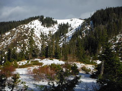
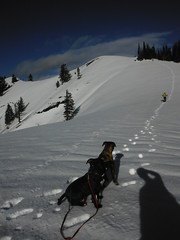
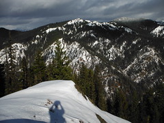
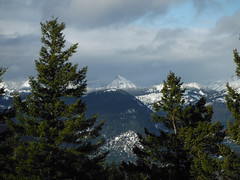
Snow began to appear just past the bridge, and was steady within a mile. There appeared to be about 4 inches of fresh powder over the snowshoe tracks I was following, which at times were tough to see. The cloudy sky cleared up quickly and I was greeted with sunshine just after the Granite Lakes/Thompson Lake junction. The march to the top got steadily tougher after around 4000' feet as the powder depth rose and wind drift caused the trail to nearly vanish.


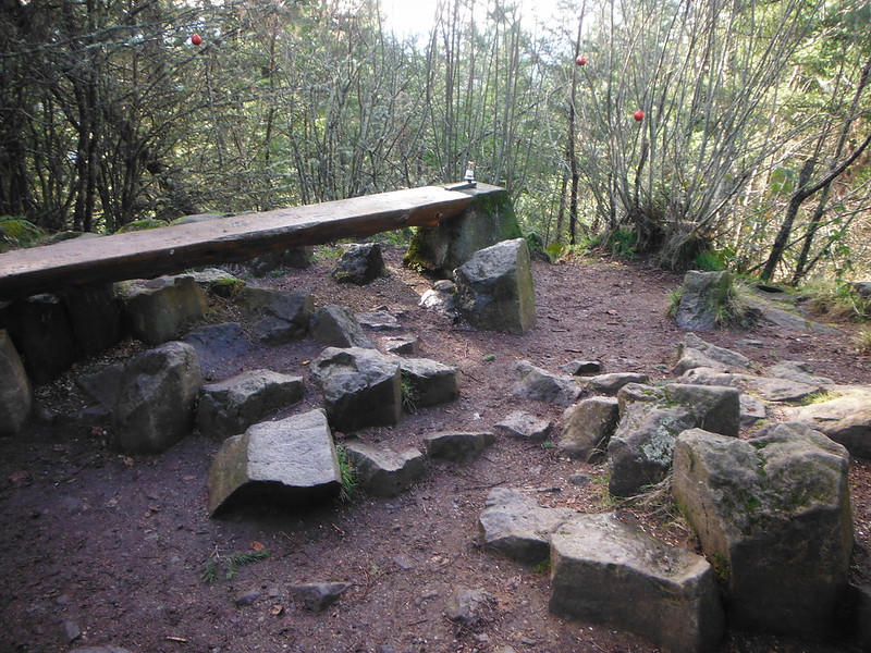
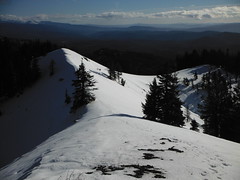
The cabin near the summit is an impressive piece of work, especially considering the beating it takes from wind rain and snow year after year. I   have been looking at it from surrounding peaks for two years now, wanting to get up close, and I'm glad to have made it before something leads to it's removal. I hoped to continue on to Revolution Peak but between the time and the post-holing I encountered in the short distance from the cabin to the summit of Thompson Point, I regretfully decided to leave it for another day.

Saturday, December 1, 2012

Pockets of Sunshine around Hex Mountain 12-1-2012


I headed East today looking for sunshine, and found it all around Lake Cle Elum. The road to the trailhead has snow at around 3000 ft but was nicely rutted out down to gravel until a half mile from the trailhead, where I parked. The road I ended up on (after trying a few possibilities for rd 116 to Trail 1343 only to find housing developments) is the second turn south of Davis Creek and was signed "Sasse Mtn Trailhead 3" at the turnoff. The sign at the TH indicates the trail as Sasse Mtn Trail No. 1302, which is not on the Green Trails Map No. 208 for Kachess Lake, and seems to be the same as Trail 1340 on that map.


Despite any confusion, the trail was straight-forward and had the intermittent snow had been stamped down by a group of 6 ahead of me :up:. Snow covered the ground from the camp at about 4000' and got at least 2' deep by the top. One of my dogs feet started to bleed less than a half mile from the top, dashing my plans to continue on to Sasse.


I passed the 2 leaders as they waited at the false summit for the rest of their group. They were slightly hesitant to accept that they weren't already on the true summit. Beyond them there was a solo set of tracks running parallel to the return set, dusted with a few inches of powder.


It was sunny at the top and not too windy either. I could see clearly to Iron, Bill and Gene Peaks to the NE and to Alta Mountain, Hibox and the 3 Queens to the West before the surrounding clouds enveloped the rest. The return was quick and uneventful.

Wednesday, November 28, 2012

Tolmie Peak Lookout 11-27-2012

I Left the gate at 8:45 and started up the dry road. Snow showed up around 4000' feet and got as deep as 2-3 feet at the summit. Several others, including a few with snowshoes have made this trip since the bulk of the snow fell, a tightly packed trail to follow with little-to-no postholing. The overcast ceiling was well above Rainier and it was surprisingly warm compared to my recent trip to the Teanaway Valley. I used the Grindstone Trail to bypass the switchbacks in the road and before long I was looking at Mowich Lake.

 Some elevation was lost on the way up to Eunice Lake, which is completely frozen over. I was a little tempted to walk a short distance out, but being alone that would have been silly and dangerous. Even with the snow softening up a bit the short climb to the lookout tower and the true summit beyond it took less effort than I expected. 

Eunice Lake


 The tower has been shuttered for the season and the door sealed with a few nails but the back side luckily provided some decent shielding from the intense wind that seemed to begin as soon as I approached the top. Views were astoundingly clear in all directions. This was my first look at Mt St Helens since childhood. I dug around in the snow on the true summit for a register but had no luck, so after a few rituals I hurried back to the shelter of the lookout tower.


The true summit from the lookout


Trekking through Powder to Earl Peak 11-25-2012

I attempted this trip the day before with the dogs but 2 miles in I noticed their paws were bleeding from the sharp icy crust covering the snow. The N. Fork Teanaway river road is currently passable by low clearance vehicles at least to Beverly creek, where a few inches of snow have been rutted down to dry gravel. The road to Beverly Creek trailhead however is covered in snow and my tires are nearly bald, so I parked and walked from the junction.


My thanks to the folks with the snowshoes who broke trail up to Bean Creek, from there on the deep snow was mostly fresh powder that had me constantly sinking to my thighs, bot not consistently enough to get used to it. The naturally snow-trenched trail was relatively easy to follow but i left it after a sketchy re-crossing of Bean Creek, opting instead to ascend to the saddle between Earl Peak and Bean Peak before continuing to Earl's summit.

Alpenglow on Mary and Judy

Icy rock in Bean Creek


Clear skies the night before meant lower temperatures today despite the ever-present sun. It took me nearly 5 hours of hard work to finally reach the summit, but the cold prevented me from lingering too long. Stuart and the Enchantments looked as impressive as ever covered in a fresh blanket of white. Bean, Mary and Judy looked tempting as I hoped to have time to make a loop of them on the way back, but the deep powder had me set on a smoother return along my own tracks.

Just below Summit

Earl Peak
Mt Stuart and the Enchantments behind me

Mount Stuart


I enjoyed a few short glissades on the way down (video here) and then settled in for a long slushy return. Just past Bean Creek a lone pair of ski tracks appeared over my trail. I met the owner as he passed me on his way out about a mile from my car, the only soul I encountered all day.